How the crowd draws
1,219 drawings of its land border and 1,018 drawings of its coast, from memory on Borderline’s World map, 16 September 2026 to 27 October 2026.
In numbers
| The real one | The crowd’s | |
|---|---|---|
| Area | 499,000 km²193,000 sq mi | 491,000 km²190,000 sq mi↓1.6% smaller |
| Outline | 5,507 km3,422 mi | 5,116 km3,179 mi↓7.1% shorter |
| Centre | 3.51° W, 40.35° N3.5° W, 40.4° N | 3.31° W, 40.41° N3.3° W, 40.4° N→18 km east11 mi east |
| Westernmost | 9.29° W, 42.92° N9.3° W, 42.9° N | 9.13° W, 43.04° N9.1° W, 43.0° N→13 km short8 mi short |
| Easternmost | 4.33° E, 39.88° N4.3° E, 39.9° N | 4.30° E, 40.00° N4.3° E, 40.0° N←2 km short2 mi short |
| Southernmost | 5.35° W, 35.86° N5.4° W, 35.9° N | 5.34° W, 35.88° N5.3° W, 35.9° N↑3 km short2 mi short |
| Northernmost | 7.69° W, 43.79° N7.7° W, 43.8° N | 7.52° W, 43.54° N7.5° W, 43.5° N↓28 km short17 mi short |
Near the land border, 46% of the crowd’s lines run inside Spain. Near the coast, 60% run inland.
Borders and coast
| Border with | In the game | The crowd’s |
|---|---|---|
| Portugal | 1,065 km in the game1,224 km officially | 899 km the crowd’s↓15.6% shorter |
| France | 564 km in the game646 km officially | 516 km the crowd’s↓8.5% shorter |
| Andorra | 53 km in the game | 42 km the crowd’s↓20.8% shorter |
| Morocco | 20 km in the game19 km officially | 19 km the crowd’s↓5.0% shorter |
| The coast | 3,205 km in the game4,964 km officially | 2,874 km the crowd’s↓10.3% shorter |
Autonomous communities of Spain
17 autonomous communities, 16 with a page- Draw
 Andalucía5.8% smaller · 122 drawings
- Draw
 Aragón4.9% smaller · 41 drawings
- Draw
 Asturias12.7% smaller · 102 drawings
- Draw
 Canarias7.4% smaller · 53 drawings
- Draw
 Cantabria10.2% smaller · 80 drawings
- Draw
 Castilla y León9.7% smaller · 43 drawings
- Draw
 Castilla-La Mancha4.3% smaller · 46 drawings
- Draw
 Cataluña4.1% smaller · 136 drawings
- Draw
 Comunidad de Madrid5.6% smaller · 57 drawings
- Draw
 Comunidad Valenciana5.8% smaller · 119 drawings
- Draw
 Extremadura6.5% smaller · 44 drawings
- Draw
 Galicia9.4% smaller · 130 drawings
- Draw
 Illes Balears0.7% smaller · 50 drawings
- DrawLa Rioja18 of 25 drawings needed
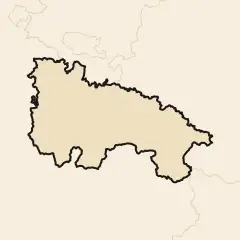 Not enough drawings yet
- Draw
 Navarra9.3% smaller · 29 drawings
- Draw
 País Vasco3.0% bigger · 90 drawings
- Draw
 Región de Murcia6.4% smaller · 82 drawings
Watch the drawings
See every line on The Drawn World →Watch every region being drawn
See every line on The Drawn Spain →How it is measured
The crowd’s Spain: every few km along the real line, each drawing’s nearest point, inside Spain or outside it; the median over a short stretch is where the crowd puts the line there, and the real outline moved by it is the crowd’s. Where the move folds a narrow inlet over itself, the loop is cut.
The 2,237 drawings that scored 10 or more on Borderline’s World map, scribbles left out, the real line the game’s own. Area true to scale; the outline copies the real line’s detail, so its length changes only where the shape moves or a loop is cut. The map lays the 1,000 most recent; the heat map, the crowd’s shape and every figure use all 2,237.
9 small pieces of Spain, 75 km² in all, keep their real shape, shown flat: islands no round asks players to draw, or too small to measure. They count in no figure.
Pieces the World map does not ask for are measured from the rounds that do: Illes Balears (50 drawings), Canarias (53 drawings).
Measuring how far the crowd moves the centre was Matt Forrest’s idea (forrest.nyc).
Draw Spain yourself and add your line to the next update.